Top Hiking Trails on the East Side
Kauai’s Royal Coconut Coast is home to great hiking trails (listed in alphabetical order) providing easy to challenging adventures in Kauai’s extraordinary mountains. Please remember to wear sunscreen, sports or hiking shoes, carry water/snacks and, if alone, provide someone with your hiking plan.
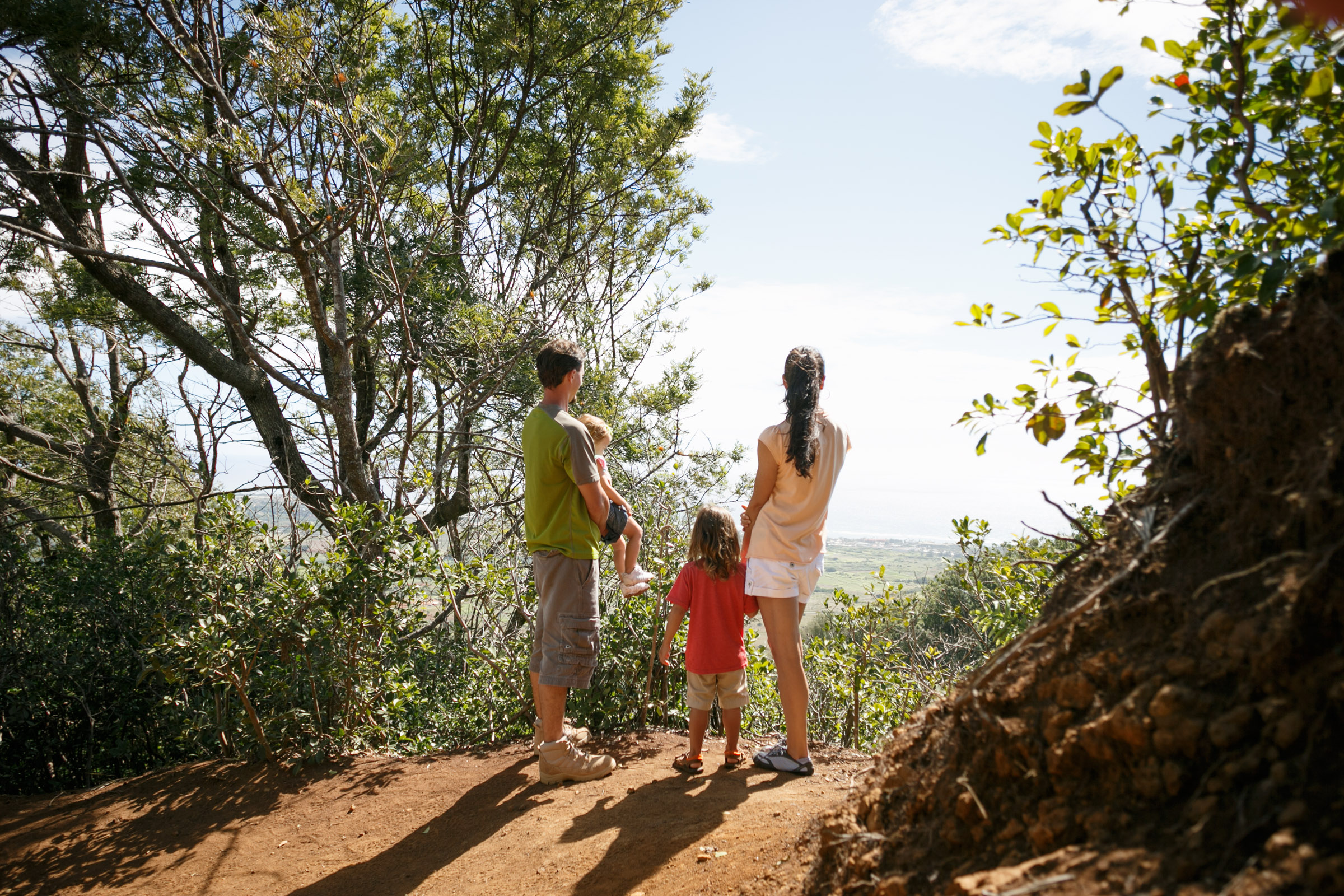
View from a bench along the trail. Photo courtesy of Outdoor Project Hiking. Photo by Shaun Hunter.
Kuamoo Trail: This trail starts beyond Opaekaa Falls on Kuamoo Road (Highway 580) and connects with the Nounou Mt. (West Side) Trail. It is routed laterally along the west side of Nounou Forest Reserve through groves of trees planted in the 1930s by the Civilian Conservation Corps. This is a moderate hike, and fairly easy until connecting with the Nounou West Trail (one way): 2 mi / 3.22 km – Elevation Change: 320 ft / 97.54. For more information go do: https://hawaiitrails.ehawaii.gov/trails/#/trail/kuamoo-trail/101
 Kuilau Ridge Trail: The trail starts on Highway 580 about 100 yards before the Keahua Forestry Arboretum. It is a very scenic route through the Lihue-Koloa Forest Reserve that ends at the Moalepe Trail. This trail, combined with the Moalepe Trail, is also enjoyed by horseback. Length (one way): 2.1 mi / 3.38 km – Elevation Change: 640 ft / 195.07 m. For more information go to: https://hawaiitrails.ehawaii.gov/trails/#/trail/kuilau-trail/91
Moalepe Trail: The trail starts in the Wailua Homesteads at the end of the pavement on Olohena Road. It begins as a right-of-way crossing a pasture lease within the Wailua Game Management Area. The trail enters the Kealia Forest Reserve at about a mile. It joins the Kuilau Trail at 2.15 miles. It is enjoyed by hikers and horseback riders. Length (one way): 2.5 mi / 4.02 km – Elevation Change: 680 ft / 207.26 m. For more information go to: https://hawaiitrails.ehawaii.gov/trails/#/trail/moalepe-trail/95
Nounou Mountain, (AKA Sleeping Giant) Trails


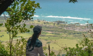
Nounou Mountain East Trail: This trail starts at a parking area adjacent to the Department of Water pump site beside Haleilio road in Wailua Houselots. It ends at a picnic shelter on the “chest” of the Sleeping Giant in Nounou Forest Reserve, where there are vistas of the ocean coastline, as well as inland to the Wailua River and Mount Waialeale. This is the more moderate of the two trails. The west side trail joins this trail near the 1.5 mile post. Length (one way): 2 mi / 3.22 km – Elevation Change: 960 ft / 292.61 m. For a more detailed description, go to: https://hawaiitrails.ehawaii.gov/trails/#/trail/nounou-east-trail/97
 Nounou Mountain West Trail: The trail begins along Kamalu Road (State Highway 581) in the Wailua Homesteads at telephone pole #11. It starts along a right-of-way and then climbs up the mountain to join with the East Trail. The route is through the Nounou Forest Reserve and timber plantations from the 1930’s. It is quite steep. Length (one-way): 1.5 mi or 2.41 km. Elevation change is 800 ft or 243 m. For more information go to: https://hawaiitrails.ehawaii.gov/trails/#/trail/nounou-west-trail/99
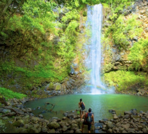 Uluwehi Falls (paddle and hike). This five-hour guided tour includes a waterfall adventure for active families, couples, friends or singles. It combines idyllic paddling on the Wailua River and, depending on weather conditions, a moderate to challenging hike to a remote bridal-veil waterfall. The Wailua River became the center of activity for early Hawaiians and is known as one of Hawaii’s two most sacred places.The trail leading to the waterfall is a beautiful “greenhouse” where flowers, brooks and ferns abound. Swimming is allowed by the waterfall. The early Polynesian culture is represented here, steeped in a colorful past, rich with rock-wall terracing, legends and lore. For more information: https://kayakkauai.com/tours/river-kayaking-tours/wailua-secret-falls-tour/